All Parks in Nova Scotia

All Parks in Nova Scotia


Parks filter

Amherst Shore

On the shore of the Northumberland Strait, offering an attractive mixed woodland setting for camping with some of the warmest saltwater swimming north of the Carolinas.

Amherst Shore Day Use

On the shore of the Northumberland Strait, with some of the warmest saltwater swimming north of the Carolinas.

Annapolis Basin Look Off

Enjoy scenic views of the Annapolis Basin as you rest at this small picnic spot. Interpretive display.

Anthony

Wharf and day-use park overlooking Cobequid Bay. Exposed red sand area at low tide offers an opportunity for walking and wading in the warm water. Interpretive display highlights the importance of the site to Aboriginal peoples, European settlers, ship building and during wartime.

Arisaig

Park is known for its fascinating geology and fossils; an interpretive kiosk examines highlights of the four million years of earth history found here. Pleasant 1.5 km walking trail through forest, and to shore access. Geocaching opportunities as well as snowshoeing and cross country skiing. Located 27 km (17 miles) north of Antigonish.

Balmoral Mills

A quiet place adjacent to the Balmoral Grist Mill Museum where you can picnic or take a stroll.  Operated by the museum.

Fishing

Barrachois

Formerly a farm, this park situated on a knoll under a canopy of trees, offers a lovely view of Bras d' Or Lake. Fishing opportunities on the lake. Located 12 km (8 mi) south of Highway 125.

Battery

Home to a number of historically significant sites, including the site of a lime kiln used to make plaster and mortar, some of which was used in the construction of Fortress Louisbourg, as well as the remains of two forts that were involved in the French and English struggle over the North American continent.

Battery Day Use

Home to a number of historically significant sites, including the site of a lime kiln used to make plaster and mortar, some of which was used in the construction of Fortress Louisbourg, as well as the remains of two forts that were involved in the French and English struggle over the North American continent.

Bayfield Beach

Sand and pebble beach offers supervised swimming on weekends. Located 6 km (4 mi.) north of Exit 36 off Highway 104, on St. Georges Bay.

Bayswater Beach

A white-sand beach and a picnic area. Beach is supervised (July-August/STC). Outdoor barbecue grills, change rooms and toilets. Located 20 km (12 mi.) south of Hwy 103, Exit 7.

Beaver Mountain

Impressive view of Antigonish County and Cape Breton Island. A 6 km (3.5 mi) trail system provides a mix of paved walkways as well as fairly challenging unpaved hills great in winter for cross-country skiing and snow-shoeing.

Bell

Bell Park is a historic 55 acre nature park located on Hwy 1 in Mount Uniacke with more than 2 km of signed trails.

Ben Eoin

Situated on a former farm this small, secluded park is nestled against a hardwood-covered hill. A short walk leads to a look-off with a view of East Bay.

Fishing

Black Duck Cove

A community managed day-use park with a small sandy beach and a 3.5 km (2.2 mi.) shoreline walking trail.

Blomidon

Rising majestically from the shores of the Minas Basin, Blomidon Provincial Park is renowned for its spectacular views. Blomidon's 759 ha (1,875 acres) include 180 m (600 ft.) high cliffs, a variety of habitats, striking natural features, abundant wildlife -- and the world's highest tides wash its shores.

Blomidon Day Use

Walk on the ocean floor at low tide and look up at the 180 metre cliffs.  Spend the day exploring the beach, walking on the 13 kms of trails, having a picnic and watching the world's highest tides.

Blomidon Lookoff

Small roadside stop with a panoramic view of the fertile farmlands of the Annapolis Valley. On a clear day you can see five counties.

Blue Sea Beach

Featuring a dune system with a low bank and wide sandy beach on the Northumberland Strait. 

Low tide exposes the long sand flats creating a great environment for family members of all ages to enjoy a beautiful day at the beach. 

Accessible Facilities

Boylston

Wooded hilltop campground with a spectacular view of Guysborough Harbour an ideal place to camp while touring the Eastern Shore conveniently located between the communities of Boylston and Guysborough (town).

Boylston Day Use

Located between the communities of Boylston and Guysborough (town), offers a spectacular view of Guysborough Harbour.

Fishing

Cabots Landing

Perched on the shore of Aspy Bay, this site features scenic vistas of the steep face of the Pollets Cove-Aspy Fault Wilderness Area. Provides access to 3 km beach walk. A National Historic Site cairn commemorates the landing of explorer John Cabot.

Caddell Rapids Lookoff

Small picnic stop overlooking the Shubenacadie River's spectacular incoming tides. Bald eagles can often be seen patrolling the river for food.

Fishing

Camerons Brook

A waterside park offering a shaded rest stop under a canopy of pine and hardwoods. Across the road is access to Ponhook Lake, a favourite for fishing and canoeing. Located approximately 40 km north of Liverpool.

Cape Chignecto

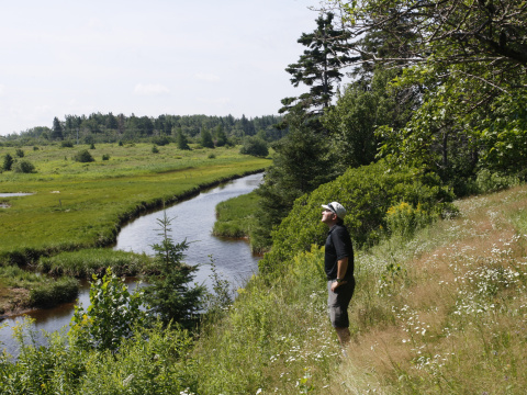
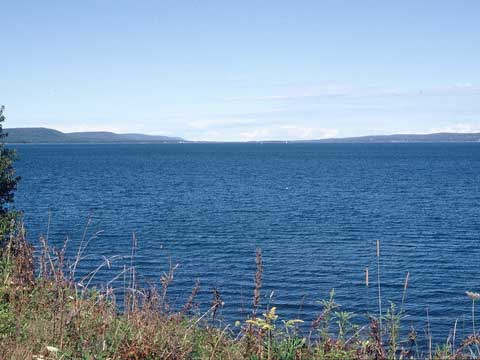
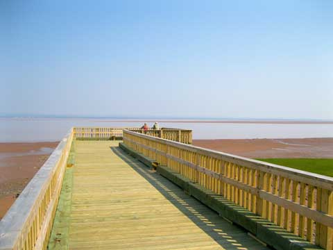
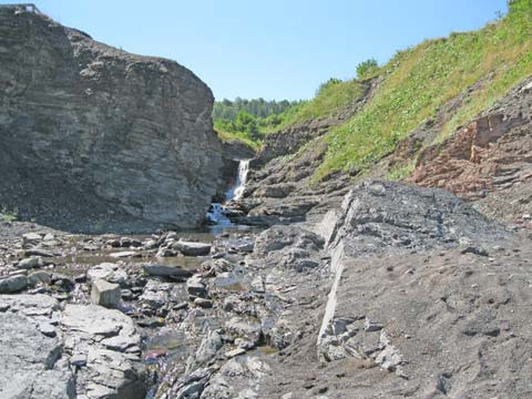
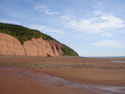
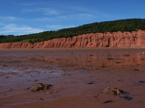
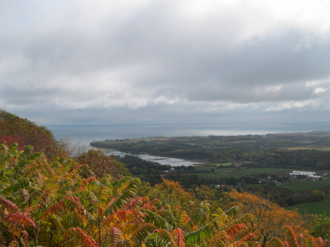
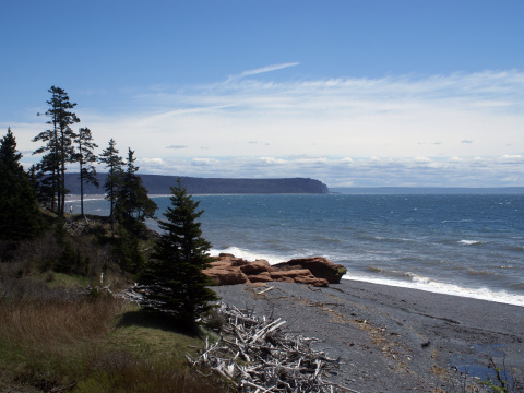
Towering 180 m (600 ft.) sea cliffs rise from the Bay of Fundy, while the world's highest tides lap at their base. Best described as a wilderness park, it has 29 km (18 mi.) of pristine coastline, deep valleys, sheltered coves, rare plants, and remnant old-growth forests. The park offers over 60 km (37 mi) of wilderness trails and remote walk-in campsites.